

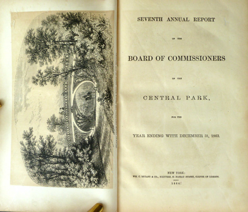
SEVENTH ANNUAL REPORT OF THE BOARD OF COMMISSIONERS OF THE CENTRAL PARK, FOR THE YEAR ENDING WITH DECEMBER 31, 1863.
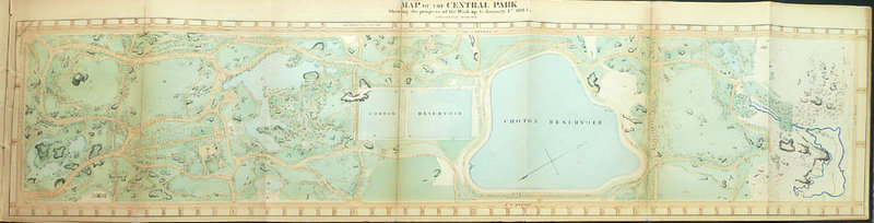
New York: Wm. C. Bryant, 1864. This seventh annual report of the Central Park Commissioners is a part of an ensemble of reports, all issued separately over the years, which constitute the one essential documentary resource for the study of America's first and most important major urban park. As reported here, in April, 1863, the Commissioners finally gained the right through the courts to acquire land between 106th and 110th streets between Fifth and Eighth avenues for extension of the park. The Board reaffirms its aim to preserve the site's natural ruggedness and views of distant landscapes. Additional work which occupied the Board this year, in addition to extending drives and walks through newly acquired land, was constructing portions of the enclosing wall, completing most of the unfinished surface of the ground below One Hundred and Second street and the stone-work of the terrace and masonry of the ravine's rustic bridge. A large colored fold-out map of Central Park shows progress of work up to January 1st, 1864. Other plates illustrate the archway under the foot-path for the bridle road south of the meadows, another archway east of the lake and another northwest of the Ramble. There are views of the casino or ladies refreshment saloon and the boat landing, north east of the lake. The whole concludes with a 33 page catalogue of trees, shrubs and herbaceous plants in the park as of Dec. 31, 1863" with the months of Flowering and Fruiting of such as have conspicuous blossoms or fruits." 8vo (23.5 x 14.5 cm); (ii) + 123 + (i) pp. + large fold-out color map measuring 23 x 87 cm. + 5 tinted lithographed views + 3 untinted lithographs.
Older rebinding in cloth, gilt lettered spine, with original wrappers bound in along with blanks for notes at end; light shelf-wear, small chip at corner of front wrapper; torn map folds neatly repaired.
Other items of possible interest…
-
 DICTIONNAIRE HISTORIQUE ET ARTISTIQUE DE LA ROSE.
 -
 CIVIC ART.
 -
 A PHILOSOPHICAL TREATISE OF HUSBANDRY AND GARDENING:
 -
 CIVIC ART.
 -
 A NEW SYSTEM OF AGRICULTURE.
 -
 AN ALBUM OF SEED PACKET LABEL ILLUSTRATIONS.
 -
 DER FRÜHLINGS-UND SOMMERGÄRTNER ODER ANWEISUNG, JEDE ART VON BLUMEN,
 -
 AN ALBUM OF SEED PACKET LABEL ILLUSTRATIONS.
 -
 AN UNUSUAL VIEW OF “CLAIES” COVERING A GLASSHOUSE.
 -
 A PHILOSOPHICAL TREATISE OF HUSBANDRY AND GARDENING:
 -
 AN ALBUM OF SEED PACKET LABEL ILLUSTRATIONS.
 -
 A NEW SYSTEM OF AGRICULTURE.
 -
 A PHILOSOPHICAL TREATISE OF HUSBANDRY AND GARDENING:
 -
 ESSAI SUR LES JARDINS.
 -
 ARBRES FRUITIERS, ARBRES D'ORNEMENT, ARBUSTES ET ROSIERS
 -
 EXQUISITE PRESENTATION ALBUM WITH TEN DELICATE CUT PAPER FLOWER DESIGNS.
 -
 COLOR LITHOGRAPHED TRADE CARD:
 -
 CATALOGUE OF PATENT TERRA COTTA ENAMELED VASES.
 -
 CIVIC ART.
 -
 COLO. BEAUTIES (cover title).
 -
 ETCHING. "View Of The Grotto Of Pan And Fame."
 -
 EXQUISITE PRESENTATION ALBUM WITH TEN DELICATE CUT PAPER FLOWER DESIGNS.
 -
 COURONNE DE FLORE
 -
 ESSAI SUR LES JARDINS.
 -
 A BOTANICAL LADDER FOR THE YOUNG.
 -
 CIVIC ART.
 -
 DER FRÜHLINGS-UND SOMMERGÄRTNER ODER ANWEISUNG, JEDE ART VON BLUMEN,
 -
 ARBRES FRUITIERS, ARBRES D'ORNEMENT, ARBUSTES ET ROSIERS
 -
 FIGURES POUR L'ALMANACH DU BON JARDINIER,
 -
 DE LA COMPOSITION DES PARCS ET JARDINS PITTORESQUES,
 -
 A NEW SYSTEM OF AGRICULTURE.
 -
 FIGURES POUR L'ALMANACH DU BON JARDINIER,
 -
 AN ALBUM OF SEED PACKET LABEL ILLUSTRATIONS.
 -
 DER FRÜHLINGS-UND SOMMERGÄRTNER ODER ANWEISUNG, JEDE ART VON BLUMEN,
 -
 40 AGRICULTURAL COTTAGES IN CORNWALL.
 -
 COLO. BEAUTIES (cover title).
 -
 AN ALBUM OF SEED PACKET LABEL ILLUSTRATIONS.
 -
 EXQUISITE PRESENTATION ALBUM WITH TEN DELICATE CUT PAPER FLOWER DESIGNS.
 -
 COURONNE DE FLORE
 -
 A BOTANICAL LADDER FOR THE YOUNG.
 -
 ARBRES FRUITIERS, ARBRES D'ORNEMENT, ARBUSTES ET ROSIERS
 -
 A BOTANICAL LADDER FOR THE YOUNG.
 -
 CATALOGUE OF CAST-IRON GARDEN VASES,
 -
 COURONNE DE FLORE